

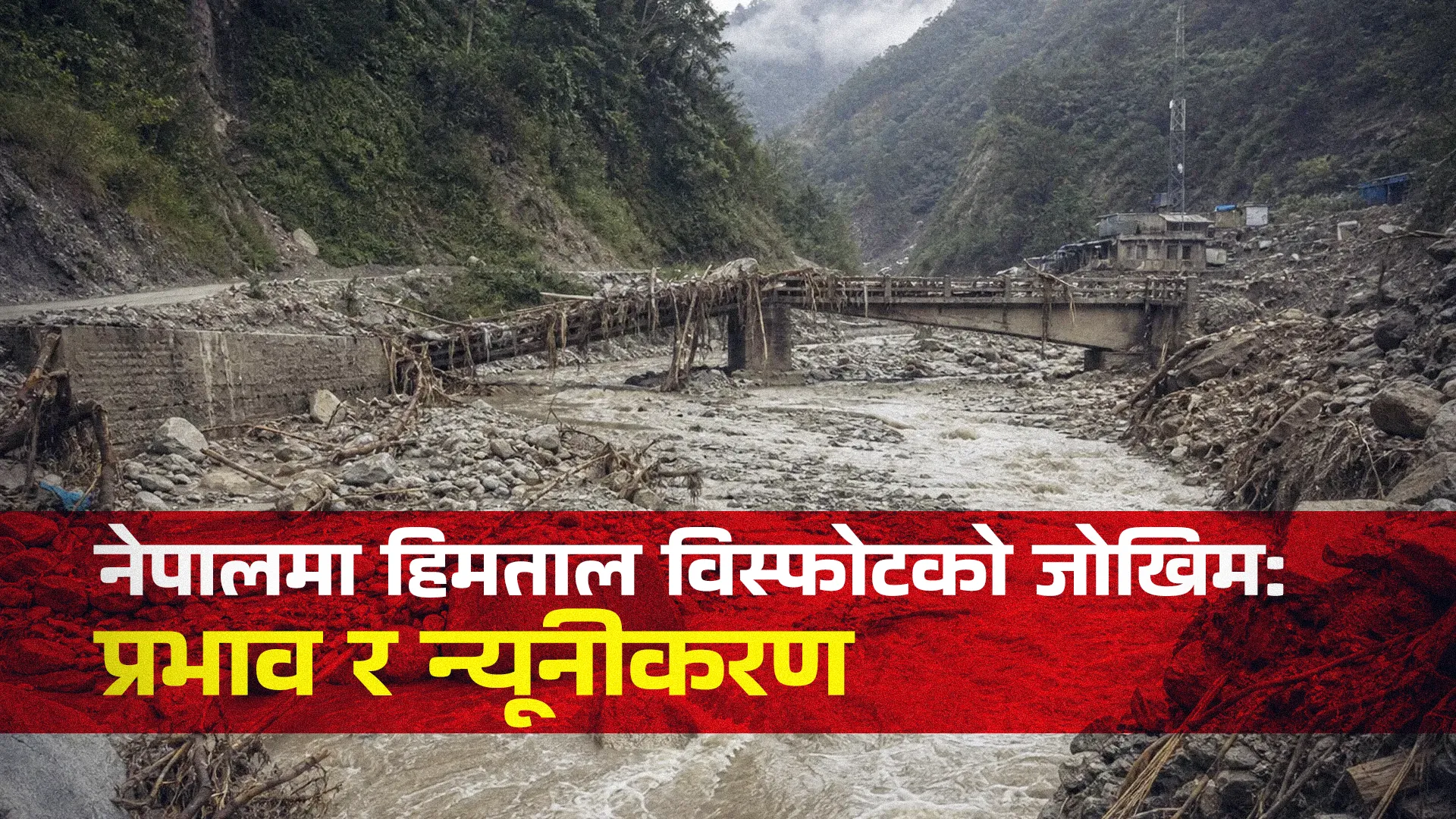
Glacial Lake Outburst Floods (GLOFs) represent one of the most severe, climate-accelerated natural hazards in High Mountain Asia, posing an acute threat to downstream human security, economic infrastructure, and environmental stability across Nepal. As global atmospheric temperatures rise, Himalayan glaciers are experiencing rapid recession and mass volume loss. Meltwater accumulates behind structurally fragile, unconsolidated moraine dams, forming high-altitude glacial lakes. When these dams breach or overtop, they release catastrophic surges of water and heavy sediment, propagating down narrow mountain valleys with immense kinetic force. Nepal’s topoclimatic vulnerability, combined with its expanding footprint of downstream infrastructure, leaves the nation highly exposed to both domestic GLOFs and transboundary flood surges originating in the Tibet Autonomous Region of China.
Cryospheric Warming and Moraine Dam Instability
Glacial retreat across the Himalayas is driven primarily by anthropogenic climate change, which has significantly altered atmospheric warming trends over recent decades. Between 1977 and 2010, Nepal lost roughly 24% of its total glacial surface area, transferring solid ice volume into expanding liquid meltwater impoundments. A temperature increase of two degrees Celsius is projected to melt up to half of the total ice volume across the Hindu Kush Himalaya, accelerating the formation of new glacial lakes and expanding existing bodies of water. In Nepal, 8.3% of glacial lakes are located below 4,000 meters above sea level, while the vast majority sit at higher altitudes directly adjacent to retreating glacier termini.
Proglacial moraine-dammed lakes represent the dominant source of destructive GLOF events in the region. These dams are formed as retreating glaciers deposit loose, unsorted detritus—comprising gravel, sand, mud, and massive boulders—at their terminal margins. Unlike engineered structures, moraine complexes lack structural cohesion and frequently contain remnant cores of buried glacial ice. Rising regional temperatures induce thermal degradation and melting of these internal ice cores, forming subsurface voids, piping channels, and structural slumping within the dam body. Concurrently, continuous meltwater influx elevates hydrostatic pressure against the dam face, steadily eroding the structural factor of safety until the dam reaches a critical threshold of instability.
Trigger Mechanisms and Downstream Hydro-Sediment Dynamics
While chronic thermal degradation weakens moraine structures over time, catastrophic dam failures are predominantly initiated by rapid, dynamic external triggers. Regional hazard documentation indicates that mass movements—specifically ice avalanches, rockfalls, and slope landslides striking glacial lakes—account for 54% of recorded GLOF events. When ice or rock masses crash into a glacial lake, they generate high-velocity displacement waves that overtop the moraine crest. The initial overtopping water rapidly scours the loose moraine material, carving an ever-deepening breach channel that rapidly releases the impounded water body.
Intense atmospheric precipitation events represent the second most prominent trigger, accounting for 18% of historical outburst floods. High-intensity rainfall rapidly accelerates surface runoff, elevates water levels within glacial lakes, and destabilizes adjacent valley slopes, triggering simultaneous slope failures. Subsurface piping—where water forces pathways through permeable sediment layers or melted ice channels—also leads to internal structural collapse without requiring an overtopping wave. Additionally, seismic activity can fracture fragile moraines or dislodge slope masses into upstream reservoirs.
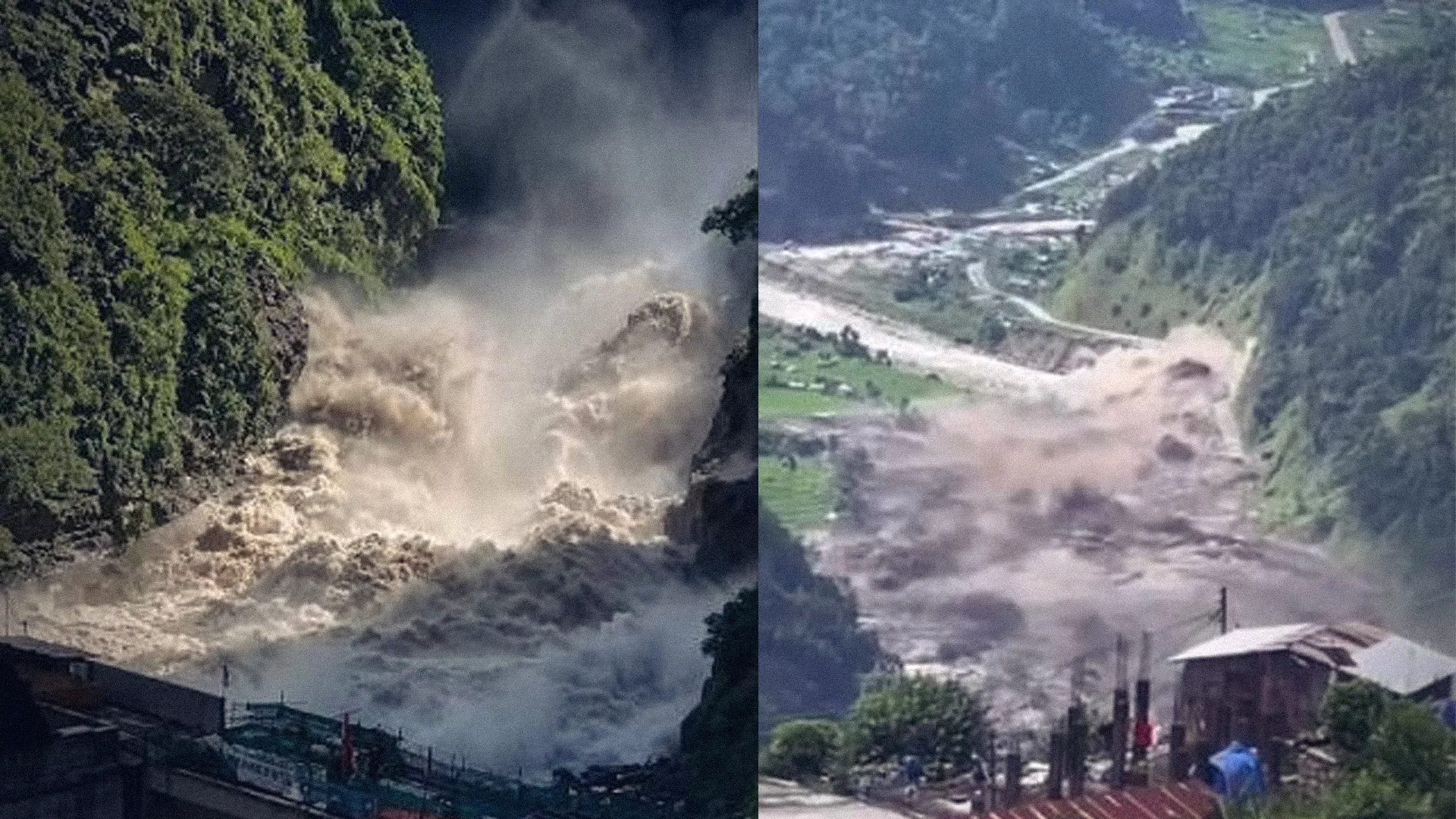
Once a breach occurs, the resulting flood wave undergoes complex hydrodynamic transitions as it descends downstream mountain gorges. The outflow rapidly transforms from a clear-water flood into a hyper-concentrated debris flow by entraining vast quantities of loose bed material, sediment, and boulders. Instrumental monitoring of historical events reveals a distinct two-stage wave delivery: an initial high-velocity surge of water, followed within an hour by a secondary surge of dense, coarse sediment carrying boulders up to six meters in width. The massive density and velocity of this hydro-sediment mixture give GLOFs extreme erosive capacity, enabling them to destroy riverbanks, strip valley vegetation, and undermine structural foundations tens of kilometers downstream.
Basin-Scale Inventory and Risk Prioritization
Comprehensive glacial lake inventories produced by the International Centre for Integrated Mountain Development (ICIMOD) and the United Nations Development Programme (UNDP) mapped 3,624 glacial lakes with surface areas equal to or greater than 0.003 square kilometers across the Koshi, Gandaki, and Karnali river basins. These three major basins encompass geographic areas spanning Nepal, the Tibet Autonomous Region (TAR) of China, and India. Within Nepal's national boundaries, 2,070 glacial lakes were mapped, alongside 1,509 lakes in TAR (China) and 45 in India that drain directly into Nepalese river corridors.
From this comprehensive inventory, 47 glacial lakes were categorized as Potentially Dangerous Glacial Lakes (PDGLs) due to their structural instability, expansion rate, and proximity to downstream communities. Geographically, 21 of these dangerous lakes lie within Nepal, 25 are located in TAR (China), and 1 is situated in India. The Koshi River basin contains the highest concentration of high-risk lakes, rendering eastern Nepal the most vulnerable hydrological zone in the country.
| River Basin System | Total Mapped Glacial Lakes (≥0.003 km²) | Potentially Dangerous Glacial Lakes (PDGLs) | Territorial Distribution of PDGLs | Primary Exposure Profile |
| Koshi Basin | High concentration in headwaters | 42 | 25 TAR (China), 16 Nepal, 1 India | Dense downstream settlements, critical trade corridors, high hydropower concentration. |
| Gandaki Basin | Moderate high-altitude density | 3 | 3 Nepal | Major transportation links, agricultural valleys, Gandak Barrage system. |
| Karnali Basin | Sparse high-altitude distribution | 2 | 2 Nepal | Isolated rural road networks, high-altitude mountain settlements. |
| Total | 3,624 | 47 | 25 TAR (China), 21 Nepal, 1 India | Region-wide threat to life, property, and civil infrastructure. |
To guide hazard management and resource allocation, PDGLs are further categorized into three operational risk ranks based on physical dam characteristics, expansion trajectory, and downstream exposure.
| Risk Classification Rank | Lake Count | Physical Assessment & Risk Criteria | Representative Lake Examples |
| Rank I (Highest Threat) | 31 | Rapid surface area growth, highly unstable moraine structure, acute exposure to ice/rock avalanches, severe downstream vulnerability. | Tsho Rolpa, Imja Tsho |
| Rank II (Moderate Threat) | 12 | Moderate dam stability, progressive meltwater accumulation; requires continuous remote-sensing monitoring. | Mid-elevation proglacial lakes |
| Rank III (Emerging Threat) | 4 | Low immediate probability of failure, but displaying progressive supraglacial ponding and ice retreat. | Developing high-altitude ponds |
Historical Chronology of Major GLOF Incidents
Nepal has a long history of catastrophic GLOF events. National registries indicate that at least 26 to 27 major GLOFs have impacted Nepal since 1977, while broader regional databases catalog 54 historical events within Nepal's hydrological influence zone. A defining characteristic of GLOF hazard dynamics in Nepal is its transboundary nature: 11 to 14 of the most destructive recorded events originated across the northern border in TAR, China, but unleashed their peak kinetic energy downstream inside Nepal.

Interested in this ad?
Would you like to continue to the link or provide your information for more details?
Please provide your information
To continue, please fill in your details
| Event Date | Source Lake / River Basin | Origin Jurisdiction | Primary Trigger Mechanism | Summary of Downstream Physical & Socio-Economic Impacts |
| July 1981 | Ci-Ren-Ma-Co (Zhangzangbo) / Sun Koshi | TAR, China | Moraine overtopping & breach | Destroyed Friendship Bridge, Arniko Highway, Sun Koshi Hydropower; USD 3M in damage. |
| August 1985 | Dig Tsho / Langmoche Valley | Solukhumbu, Nepal | Ice avalanche impact wave | Obliterated Namche Small Hydropower plant, 14 bridges, trails, and farmland. |
| July 2016 | Gongbatongshacuo / Bhote Koshi | TAR, China | Moraine structural collapse | Swept away 20 concrete homes, school, customs post, highway sections; USD 70M damage. |
| August 2024 | Thyanbo Lake / Thame River | Solukhumbu, Nepal | Melt expansion & moraine breach | Wiped out Thame village; destroyed 1 school, 1 health post, 5 hotels, 7 homes; 135 displaced. |
| 2025 | Lhende Khola / Bhote Koshi | Rasuwa, Nepal / TAR Border | Ice-rock avalanche into supraglacial lake | Severe mudflows across Nuwakot; damaged bridges; downstream alerts to India. |
Detailed empirical analyses of historical events offer vital insights into failure dynamics. The August 1985 Dig Tsho GLOF occurred when an estimated 100,000 cubic meters of ice avalanched into a moraine-dammed lake, generating a displacement wave that overtopped the dam and released 6 to 10 million cubic meters of water. The resulting flood surge destroyed the recently completed Namche Small Hydropower Plant, 14 bridges, and extensive trail networks, serving as the primary catalyst for formal cryospheric hazard research in Nepal.
In July 2016, the breach of Gongbatongshacuo Lake in TAR, China released over 100,000 cubic meters of water into the transboundary Bhote Koshi River. The flood swept away 20 concrete residences, a boarding school, customs facilities, and major highway bridges, incurring an economic loss of approximately USD 70 million. Seismic monitoring along the riverbed captured the arrival of two distinct flow phases: an initial clear-water surge, followed less than an hour later by a high-density mud and sediment slurry transporting boulders up to six meters in diameter.
On August 16, 2024, an outburst from Thyanbo Glacial Lake devastated Thame village in the Solukhumbu district. Pre-event satellite imagery measured the lake's surface area at 0.05 square kilometers at 10:46 AM, shortly before a total structural breach occurred at approximately 1:25 PM. Driven by thermal degradation and melt expansion, the resulting surge obliterated 14 structures—including five hotels, seven homes, a school, and a health clinic—displacing 135 residents and burying historical Sherpa settlement grounds under sediment.
In 2025, a supraglacial lake breach in the Rasuwa district, triggered by an ice-rock avalanche into the Lhende Khola headwaters, caused widespread destruction downstream. The flood mudslides inundated multi-story structures in the Nuwakot district, damaged road networks, and forced emergency discharge management downstream at the Gandak Barrage along the Indian border.
Vulnerability Across Socio-Economic and Transboundary Domains
GLOF events act as severe threat multipliers across Nepal, creating interconnected impacts that affect human security, infrastructure resilience, and geopolitical stability. Nepal loses an average of 333 human lives and over USD 17.24 million (NPR 2,099 million) annually to water-induced disasters, with major GLOF events causing severe spikes in localized mortality, economic loss, and long-term population displacement. Remote mountain communities lose vital housing assets, health infrastructure, and educational institutions in minutes, disrupting livelihoods tied to high-altitude agriculture and trekking tourism.
Nepal's long-term economic strategy relies heavily on run-of-the-river hydroelectric power, with projects situated inside narrow mountain valleys directly downstream of PDGLs. GLOFs pose a direct threat to these installations: flood surges destroy intake structures, erode turbine machinery via heavy sediment transport, and fill reservoirs with bedload sediment. The recurring destruction of critical transport corridors—such as the Arniko Highway connecting Nepal and China—disrupts bilateral trade, severs supply lines, and imposes immense post-disaster reconstruction costs on the national budget.
Transboundary risk dynamics further complicate national security planning. More than 85% of high-risk Himalayan transboundary river basins are situated adjacent to the Nepal-China border, with over 1,500 of the 3,600 mapped glacial lakes located in TAR, China. Outburst events originating in Tibetan catchments regularly propagate into Nepalese territory, causing extensive damage. This physical reality underscores that domestic disaster risk management in Nepal cannot be isolated from international scientific collaboration, joint hydrometeorological monitoring, and formal cross-border early warning protocols.
Engineering Remediation, Monitoring, and Disaster Governance
To mitigate GLOF risks, Nepal has pioneered targeted high-altitude engineering interventions designed to reduce hydrostatic pressure on fragile moraine dams. At Tsho Rolpa, situated at an elevation of 4,580 meters above sea level in the Rolwaling Valley, an engineered open-cut channel was carved through the terminal moraine to lower the water level, successfully mitigating the breach risk of a 100 million cubic meter reservoir. Similarly, in 2016, the Government of Nepal, in partnership with the UNDP and the Global Environment Facility, successfully lowered the water level of Imja Tsho by constructing an open-cut outlet channel and installing community-level warning infrastructure.
Complementing structural remediation, non-structural adaptation measures have expanded across high-risk river basins. Community-Based Flood Early Warning Systems (CBFEWS) integrate automated water-level sensors, acoustic warning sirens, and local disaster management committees to provide downstream populations with actionable lead-time to evacuate. Satellite remote sensing, automated weather stations, and Digital Elevation Model (DEM) hydrodynamic modeling enable continuous tracking of glacial lake growth, slope movement, and potential flood inundation pathways.
From a governance perspective, integrating GLOF hazards into national security frameworks, river basin planning, and infrastructure design standards remains essential. Regional organizations such as ICIMOD facilitate standardized GLOF risk assessment methodologies across High Mountain Asia, establishing technical frameworks for hazard prioritization. Strengthening bilateral mechanisms between Nepal and China for real-time satellite data sharing, joint monitoring of border lakes, and synchronized hydro-meteorological forecasting represents a critical priority for long-term climate adaptation and disaster resilience.
Strategic Conclusions
Glacial Lake Outburst Floods represent a growing threat to Nepal's sustainable development, national security, and mountain communities. Driven by climate warming, rapid glacier retreat continues to fill high-altitude lakes impounded by unstable moraines. Historical incidents—including the Dig Tsho, Gongbatongshacuo, Thame, and Rasuwa outburst floods—demonstrate that GLOFs produce severe downstream impacts, destroying vital infrastructure, wiping out mountain settlements, and causing severe economic losses.
Managing GLOF risks effectively requires a multi-faceted operational strategy. Structural engineering solutions, such as controlled lake lowering, must be expanded to cover additional Rank I PDGLs. Non-structural interventions—including automated early warning networks, remote-sensing monitoring, and community preparedness programs—must be systematically integrated across all high-risk river basins. Finally, establishing robust, binding transboundary agreements for real-time hydrological data sharing between Nepal and China is essential to protect downstream lives, safeguard critical energy assets, and secure resilient infrastructure across the Himalayas.