
On Paper but Not on the Ground: Nepal’s Lipulekh Map Sparks Fire as India, China Trade
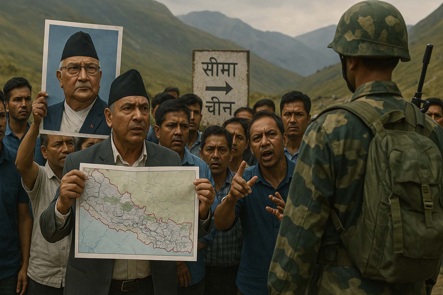
A statement from India’s Ministry of External Affairs on August 20, 2025 has reignited one of South Asia’s most sensitive border disputes. Spokesperson Randhir Jaiswal asserted that “border trade between India and China through the Lipulekh pass has been ongoing since 1954” and dismissed Nepal’s claims as “neither justified nor based on historical facts and evidence.” Kathmandu responded on August 21 with its own statement, reaffirming that Lipulekh, Kalapani, and Limpiyadhura are an “integral part of Nepal” as enshrined in its constitution, and calling on India to refrain from any activities in the contested territory.
Yet Nepali citizens are asking a deeper question—why has their government never maintained a tangible presence in these lands? No population census has ever counted residents in the disputed area, no elections have been held there, and administrative clarity remains vague. Local officials say the area falls within Byas Rural Municipality of Darchula District, but on the ground, state presence is virtually absent. This vacuum has given India a stronger hand in asserting its position.
The controversy traces back to June 2020, during Prime Minister K.P. Sharma Oli’s second tenure, when his government amended the constitution to incorporate a new political map including Limpiyadhura, Lipulekh, and Kalapani. The process was swift: cabinet approval on June 2, parliamentary tabling by Minister Padma Aryal on June 4, unanimous endorsement by the House of Representatives on June 13, and final certification by President Bidya Devi Bhandari on June 27. The revised map was hailed by Oli’s supporters as a “historic assertion of sovereignty,” but critics argue it was more about inflaming tensions with India than establishing genuine control. “Oli showed nationalism on paper but failed to secure physical presence,” one analyst noted, while his allies counter that the amendment opened the path for Nepal to strengthen its rightful claims.
Now, India and China’s decision to resume the long-stalled Lipulekh trade has “poured ghee on the fire,” in the words of Kathmandu’s diplomatic circles. Nepal’s Ministry of Foreign Affairs reiterated in its latest statement that it remains “committed to resolving boundary issues with India through dialogue and diplomacy,” but the reality is that such dialogue has been stalled for over a decade.
From road expansion to renewed cross-border trade, India’s moves have cast doubt on Nepal’s constitutional map and raised sharp questions over sovereignty. Civil society voices are increasingly pointed: “The map is in the constitution, but where is the government’s presence?” India, meanwhile, has doubled down, rejecting Nepal’s claims as “unilateral and untenable.”
The Lipulekh dispute underscores an old Nepali proverb: “Secure your own purse tightly, and do not blame others.” Sovereignty cannot rest on constitutional maps alone—it requires census, governance, and citizens on the ground. The question now is whether Nepal will muster the political will to assert real presence in its claimed territories, or remain confined to symbolic protests as India and China move ahead.


![From Kathmandu to the World: How Excel Students Are Winning Big [Admission Open]](https://www.nepalaaja.com/img/70194/medium/excel-college-info-eng-nep-2342.jpg)